
Guest reading progress stays in this browser and is not synchronized to your account automatically. Use the learning panel to include browser marks and save them explicitly. Clearing site data removes browser marks.
Your learning notebook
Save courses and review situations deliberately. Load your account records on another device when you want to continue.
Bookmarks and review choices stay in this browser until you load and save an account. Answers and time spent reading are not recorded.
Saved courses
Saved situations to revisit
Find your marked situations by title or topic, then open the original question and explanation.
Your review choices will appear here when this learning view is ready. Use the account controls above to load account choices.
No situations are marked for review in this learning view.
No saved situation matches these filters. Clear the search or choose all topics.
Identification practice
Land access practice
Field decisions practice
Harvest care practice
Audit a season row before copying its dates ↓
Saskatchewan hunting hours: read a dated clock card ↓
Beginner workshop · turn reading into a plan
Audit a season row before copying its dates
Use one reading record for one person, one intended position and one activity. Fill the trip column first, then compare it with the complete official table row and all its notes. A date match cannot fix a mismatch elsewhere in the row.
These are reading prompts and fictional changes, not an additional season table. No opening date, bag limit or eligibility is inferred here. Use the current official guide and its later updates for the real values.
This table scrolls horizontally. Focus it and use the arrow keys to reach every column.
| Field | Write this from your trip | Compare with the official source |
|---|---|---|
| Guide / season year | The intended outing date, including the year. | Cover, table heading and any later supplement; a sales date is not an opening date. |
| Exact hunting position | The actual location and any named area, not only the nearest town. | WMZ boundary and any special-area table or local condition. |
| Residency and participant category | The category confirmed for this person. | The table heading and row that apply to that category. |
| Species and harvest category | The identified species and the applicable licence category. | Read the category label rather than borrowing a similar species or sex entry. |
| Licence and method / phase | The actual licence type and intended method. | Keep Regular / Draw distinctions and separate method rows attached to their dates. |
| Dates, notes and updates | The proposed date plus any condition still unresolved. | Read the footnote and the area it covers; then check access separately. |
Work through a change
The date fits, but the row says Draw and your document says Regular. What now?
Keep the licence mismatch visible. Do not copy the dates and erase the row label. Find the table entry for the actual person, licence and activity; if you cannot identify it confidently, ask the responsible service.
Record which source, heading and note you used. An adjacent row with a convenient date is not a substitute for a matching row.
A named park or other special area appears beside the ordinary WMZ entries. Can the nearby zone answer for it?
Check whether the actual intended position falls under a separate area entry or a specifically described part. Keep the full name and the limited geographic wording in the record.
Do not apply the whole nearby WMZ to a smaller named area, or a limited-area entry to a whole property. Resolve the location first; then complete the date and conditions check.
Tomorrow’s plan changes the person, place or method. Which fields need reopening?
Underline every changed field before looking for a new date. Recheck the table headings, relevant row and attached notes together; changing one field can move the whole outing to another entry.
Keep an unresolved item as unresolved. The site’s season finder can help locate reference entries, while the complete official source, actual licence and land arrangements still need to agree.
Official requirements and maps
Saskatchewan hunting hours: read a dated clock card
Season dates and daily hours differ. Practise at home; retain destination, date, source and time zone with actual sunrise and sunset entries.
Original reading exercise for ordinary licensed hunting, not today’s hours or approval to hunt. The invented clock has no actual place or date. Access, species, season, licence conditions and safe identification remain separate checks.
Connect four checks before setting an alarm
- Match the hunt
Read the applicable species, season, place and daily-hours rule.
- Label the solar data
Check date, destination, sunrise, sunset and the selected time zone.
- Calculate and compare
Apply the stated offset; compare the result with the clock you will carry.
- Reserve the return
Plan an earlier practical finish when conditions or the route require it.
Focus this table and use arrow keys to read all three columns on a small screen.
| Input or operation | Invented clock reading | Meaning to retain |
|---|---|---|
| Sunrise | Input, not the start time by itself | |
| Sunrise minus 30 minutes | Morning boundary in this calculation | |
| Sunset | Input, not the end time by itself | |
| Sunset plus 30 minutes | Evening boundary in this calculation |
Provincial section 11(1) prohibits hunting from sunset plus 30 minutes to sunrise minus 30 minutes. Federal section 28(3)(b) uses the half-hour period south of 60° north unless Schedule 3 differs; the current Saskatchewan summary agrees. This arithmetic establishes no available hunt.
Try three changes to the clock card
Saskatchewan hunting hours: what changes when the destination moves?
A saved image names the home city. The group copies its time for another destination because the date matches. The location input remains unresolved; a season table cannot repair a mismatched solar entry.
Use the actual destination and date. NRC offers location and time-zone inputs. Retain those selections with the result, rather than an isolated time; compare the field clock to that time basis.
Next step: Replace the incomplete card and recalculate before relying on its alarm.
The app shows daylight or civil twilight rather than sunset
The sky remains bright after the evening boundary. An app value is labelled civil twilight. The rule still refers to sunrise and sunset; brightness does not replace that input.
NRC states ±2-minute accuracy for its calculations. That describes data, not a two-minute legal extension. Do not turn uncertainty or a rounded display into extra hunting time.
Next step: Check the field label, date and time zone; resolve unclear data before using the boundary.
The daily window ends later than the group can comfortably return
The fictional party needs packing and return time. Put those tasks on a separate planning line and choose a stop leaving sufficient room. The outer hunting-hours boundary is not a target to stay until.
Do not assume every setup, movement or retrieval activity outside the window is lawful because no shot is planned. This card neither classifies those activities nor grants access. Read applicable rules; ask the Ministry about unresolved activities.
Next step: Keep the earlier return decision and the legal-hours check as separate entries.
Selected hours references checked: Government-hosted clauses, the federal summary and NRC inputs were checked. The provincial PDF is a reference consolidation; original enactments govern interpretation. The Guide comparison uses the previously verified 2026–27 snapshot.
Daily limits do not settle every exception or activity
Section 11(3)’s narrow exception concerns licensed trappers taking fur animals by trap in an open fur season, not general night hunting. This exercise does not determine rights, special authorisations or activity legality.
Review federal and provincial requirements for migratory birds. Current closures, site conditions and actual documents may add constraints; the calculation does not remove them.
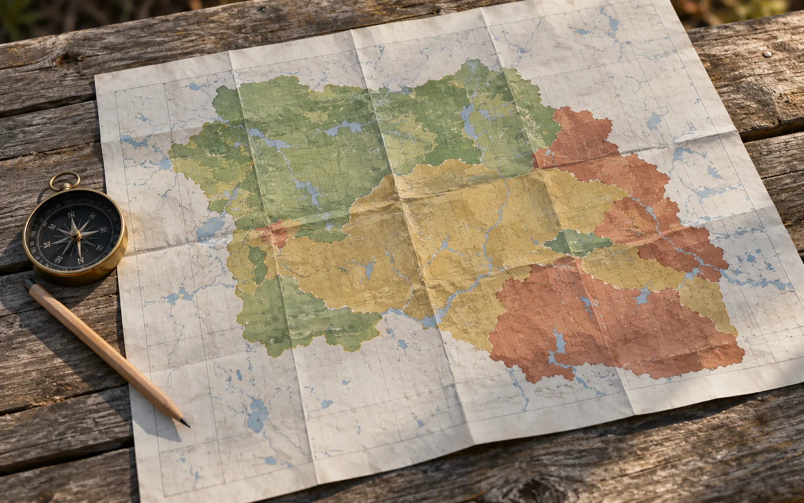
Original AI-generated photo-style teaching scene for SKHunter; depicted people, documents and maps are illustrative.
Image credit: SKHunter · original AI-generated photo-style imageWhat you will learn
- Keep a location check separate from a season-table check.
- Read a table as a complete set of conditions.
- Record uncertainty near a boundary instead of hiding it.
An original SKHunter learning guide
Keep three different questions separate
Teaching diagram · not a map- 01The land
Who can authorise this visit, and what conditions apply?
- 02The hunt
Do the current species, zone, date and personal licence conditions match?
- 03The approach
Can you reach the place and return by a checked, lawful route?
A favourable answer to one question does not answer the other two. Keep the evidence for each check.
Start with a location evidence card
Write the parcel’s legal description or a reliable coordinate, the map source and the point you intend to use. Add a small context map with nearby roads or landmarks. This helps another person reproduce the location rather than relying on a remembered nearest town or a screenshot without a scale.
If a parcel is near a boundary, describe the uncertainty explicitly: “zone not confirmed for the intended position.” Zooming further into an unofficial layer does not automatically improve its authority. Compare the current official map and descriptions, and ask for clarification when the two cannot be confidently matched.
Read across, then below
Treat a season table like a form whose fields must all match: year, species, person or residency category, zone, licence category, method and dates. Read the whole applicable row before extracting a date. Then follow every referenced note and any later update linked from the official source.
Build a small reading record with two columns: the table field and the value for your trip. If one field is unknown, leave it blank and write the question beside it. A date copied from a neighbouring row can look convincing while belonging to a different category; the field-by-field method makes that error visible.
Check the chain when one link changes
Think of the conclusion as a chain: location leads to the relevant area, which leads to a particular set of rules for your circumstances. Moving the intended position, changing the date or switching species can break that chain. Preserve your previous notes, but start a fresh check for the altered outing.
Use SKHunter to compare and organise the information, then retain the official page and its notes with your private trip record. Federal migratory-bird districts and provincial WMZs need their own appropriate references. Similar labels are not enough to substitute one system for the other or settle a boundary question.
Worked example: the marker is close to a zone edge
A parcel reference marker appears on one side of a boundary, but the place you intend to visit is farther across the parcel. The marker alone does not answer your location question.
Put it into practice
- Identify the intended position rather than using only the parcel reference marker.
- Compare that location with the current official zone material.
- Write down any remaining ambiguity and seek clarification before relying on a row.
- Once the location is resolved, read the complete applicable row and its notes.
Four checks before the field
A 36-second photographic motion explainer with gentle camera movement, four clear chapters and large on-screen words. Silent; optional captions and a transcript are available.
Choose a section or use the player controls. A text transcript is available below.
Read the video transcript
- 0:00
Start with the parcel — Identify the exact land and the surrounding approach.
- 0:09
Check land permission — Confirm who may enter, when, and under which conditions.
- 0:18
Read the complete season row — Match species, zone, licence and date. Read the attached notes.
- 0:27
Verify a usable route — A parcel pin is not an entrance. Keep a checked fallback.
Common mistakes to avoid
Reading the date before choosing the row
Match all relevant fields before copying a date.
Using a town name as a zone determination
Locate the actual intended position and check the official boundary.
Dropping footnotes from a screenshot
Save enough context to keep the conditions attached to the row.
The opening date matches your plan, but the licence category in that row does not. Is the row a usable match?
- No; find the row and conditions matching the actual circumstances.
- Yes; the opening date is the important part.
- Yes; a map marker overrides the category.
Show the answer and explanation
Answer: A. No; find the row and conditions matching the actual circumstances.
A table entry is a combination of conditions. Matching one date cannot compensate for a mismatch in another field.
Terms on this page
Open a term for its meaning, a common mix-up and the existing guide. English terms and acronyms are retained.
WMZ
Wildlife Management Zone: a provincial zone reference used when locating the relevant Saskatchewan hunting information.
Common mix-up: A provincial WMZ label is not interchangeable with a federal migratory-bird district.
quarter section
A directional quarter of a section in a rural legal land description, commonly labelled NE, NW, SE or SW.
Common mix-up: A land-description reference does not itself provide a checked entrance or the boundary geometry shown by a map record.
Current checks and official context
Locate the land, then check the boundary
Find the legal land description or reliable coordinates for the intended location. Compare the official Wildlife Management Zones map with nearby roads and landmarks. A municipality, nearest town or parcel reference point is not a substitute for a boundary check. Land close to a zone edge needs particular care.
- Write the WMZ alongside the parcel reference.
- Inspect whether the parcel intersects more than one zone.
- Resolve ambiguous boundaries using the official descriptions or ministry advice.
Read the complete row and its notes
Use the current season year, then match species, hunter residency, licence and hunting method. Read the footnotes and supplementary notices attached to the table. Keep provincial WMZ information distinct from the federal migratory-bird hunting districts; similar map labels do not make the systems interchangeable.
- Check opening and closing dates together.
- Check sex or age restrictions and other licence conditions where relevant.
- Read local closures and later amendments, not only the table heading.
Keep the decision tied to the actual outing
Save the official link, applicable page and date of your check in your trip notes. Recheck when the date, species, method or destination changes. SKHunter’s parcel season panel is a useful comparison tool; it cannot establish that every restriction, temporary notice or individual licence condition has been satisfied.
Turn this lesson into your next outing
Review the date, species, starting template and linked day plan in an editable preparation draft. You choose what to add and save.
Prepare your own trip
Review a preparation draftContinue learning
Work out which licences and documents you needTry a practical situation
Open related practiceOpening a draft does not create a saved checklist. A checked item records your own review, not permission or an open season.
Scenario practice
Put your field decisions into practice.
Try 24 situations across identification, access, field adjustments and harvest care. Compare your choice with the explanation, then revisit the relevant lesson.
Original sources
- Government of Saskatchewan · Hunters Extras, maps and access
- Government of Saskatchewan · Hunters Guide and updates
- Environment and Climate Change Canada · Saskatchewan migratory-bird summary
Use this as a planning guide. Check current official requirements and site conditions before travelling.
Help improve this guide
Tell the editor about something on this public page that needs attention.